




HMAP World Story
 HOME
HOME

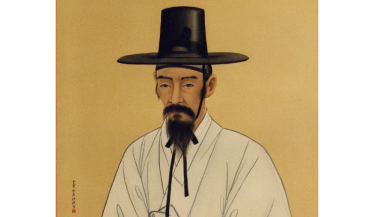
김정호 (1804-1866)
조선 후기의 대표적인 지리학자이자 지도 제작자이다. 정확한 출생 연도와 출신 배경은 알려져 있지 않지만, 19세기에 활동하며 우리나라의 지리와 지도를 체계적으로 정리했다. 김정호가 제작한 1861년에 완성된 <대동여지도>는 전국의 산과 강, 도로, 마을, 행정구역 등을 상세하게 표시한 대형 전국 지도다. 또한 <청구도>와 <대동지지>등을 제작·편찬하여 조선의 지리 지식을 발전시키는 데 큰 역할을 했다. 특히 김정호는 전국을 직접 답사하여 지도를 만들었다는 이야기가 널리 알려져 있지만, 그가 전국을 모두 직접 답사했다는 확실한 역사적 증거는 없다. 기존 지도와 지리서를 폭넓게 참고하고 이를 종합하여 지도를 제작한 것으로 보는 것이 현재의 일반적인 견해이다.
Kim Jeongho (1804-1866)
Kim Jeong-ho was a Korean geographer and cartographer. His art name was Gosanja. He was born in Hwanghaedo. It is believed that he walked the entire length and breadth of the Korean peninsula, through mountain and valley, in order to research and compile his magnum opus, the Daedongyeojido, a map of Korea that was published in 1861, from which a single-sheet version, the Daedongyeojijeondo, was subsequently made.
[Learn more]Source : Wikipedia

ⓗ Daedongyeojido (1861) / 대동여지도
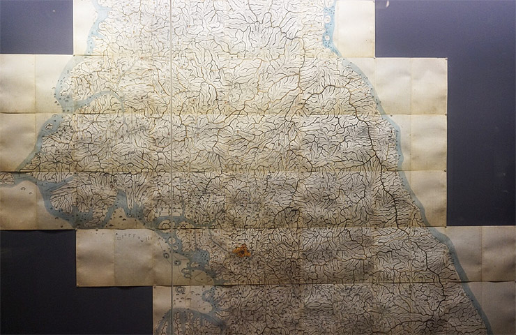
대동여지도
조선 후기의 지리학자 김정호가 제작한 우리나라의 대표적인 고지도이다. 1861년 처음 간행되었으며, 당시까지 축적된 지리 정보를 바탕으로 전국의 산맥과 하천, 도로, 고을, 군사시설 등을 매우 상세하게 표시하였다. 특히 지도를 여러 장의 목판에 새겨 인쇄할 수 있도록 만든 것이 특징이며, 휴대와 보관이 편리하도록 22첩으로 구성하였다. 1864년에는 일부 내용을 수정한 두 번째 판본도 간행되었다. 『대동여지도』는 조선 시대 지도 제작 기술과 지리 지식의 수준을 보여주는 대표적인 문화유산이다.
Daedongyeojido
Daedongyeojido is a large scale map of Korea produced by Joseon dynasty cartographer and geologist Kim Jeong-ho in 1861. A second edition was printed in 1864. One source describes it as the "oldest map in Korea". Daedongyeojido is considered very advanced for its time, and marks the zenith of pre-modern Korean cartography.
[Learn more]Source : Wikipedia
 0
0h·map story
my story


ZanzibarCEO Yun Jeong Choi
204, Dongsan-ro 14Gil 49, Seocho-Gu, Seoul, Republic of Korea
T. +82-10-6314-0823 Business License. 259-06-01622
E-Mail : humanmap@naver.com
※ Zanzibar, a stock company, is a broker of telecommunication sales
and is not a party to telecommunication sales.
Therefore, the company shall not be held liable for goods, transaction information or transactions.