HOME
HOME


바티르의 문화경관
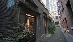
예루살렘으로부터 남서부 방향으로 수 킬로미터 떨어진 곳, 나블루스(Nablus)와 헤브론(Hebron) 사이의 중앙 고원지대에 있다. 바티르(Battir) 언덕의 경관은 돌로 축대를 쌓은 계단식 밭으로 이루어져 있다. 그 중 어떤 밭에는 물을 대서 현금 작물을 경작·생산하지만, 물을 대기 어려운 건조한 밭에는 포도 넝쿨과 올리브나무를 심어 경작하는 ‘위디안(widian)’이라고 알려진 골짜기로 이루어져 있다. 이처럼 높은 산지에서 계단식 농업이 발달하게 된 것은 지하수를 이용한 관개수로망이 건설된 덕분이었다. 이런 관개수로를 통하여 인근의 바티르 계곡에서 취수한 물은 전통 방식에 따라 각 가구로 공평하게 분배되어 사용되었다.
[자세히보기]출처 : UNESCO
Land of Olives and Vines – Cultural Landscape of Southern Jerusalem, Battir
This site is located a few kilometres south-west of Jerusalem, in the Central Highlands between Nablus and Hebron. The Battir hill landscape comprises a series of farmed valleys, known as widian, with characteristic stone terraces, some of which are irrigated for market garden production, while others are dry and planted with grapevines and olive trees. The development of terrace farming in such a mountainous region is supported by a network of irrigation channels fed by underground sources. A traditional system of distribution is then used to share the water collected through this network between families from the nearby village of Battir.
[Learn more]Source : UNESCO

 0
0